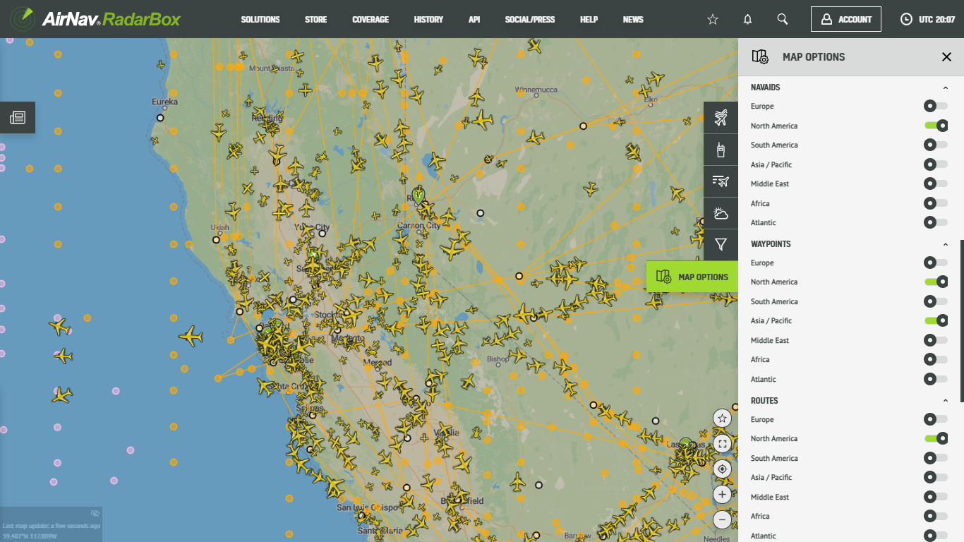
AirNav Radar Features: NAVAIDs, Waypoints & Routes
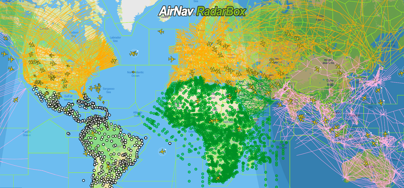
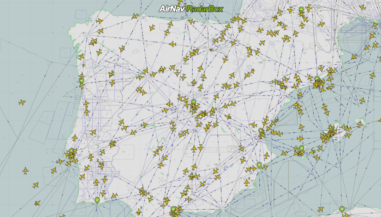
The image above: NAVAIDs/Waypoints & Flight Routes displayed around the world
This week AirNav RadarBox's feature of the week focuses on NAVAIDs, waypoints, and routes, a set of navigational features available on the Radarbox.com website. NAVAIDs, waypoints, and routes are essential tools used in flight planning and navigation in the aviation industry. These features can be turned on individually or all together and are colored based on geographic region for easy identifcation. Let's explore these features now!
Routes
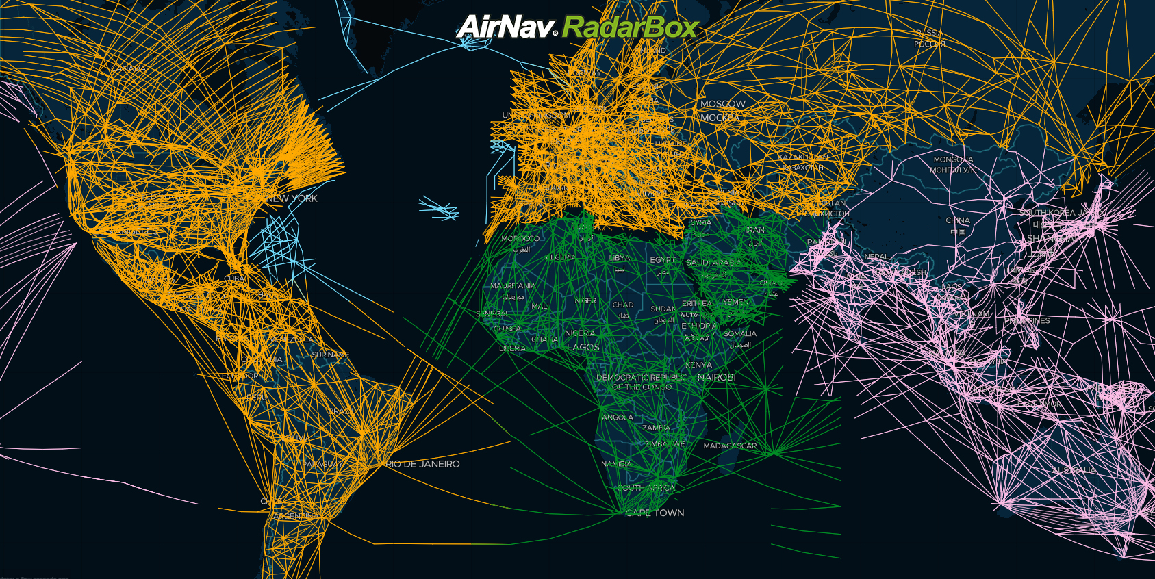
The image above: Flight Routes displayed on the RadarBox map
Routes, known as "highways in the sky," show the various fixed tracks and routes that aircraft and flights fly on. Each region of the world has its own color-coded routes for clear distinctions between the continents. We currently display routes over the Americas (South America, Central America & North America), Asia, Africa, Europe, the Middle East, and the Atlantic and Pacific Oceans.
NAVAIDs
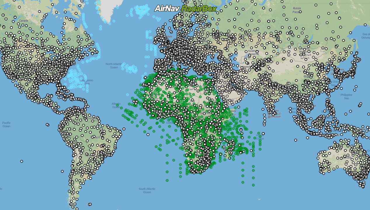
The image above Navaids & Waypoints displayed over 6 continents
NAVAIDs refer to navigation aids. These are essentially the radio beacons that help pilots navigate while flying. Similar to the routes feature, users can turn them on for each continent, and RadarBox displays navaids over Asia/Pacific, Americas, Middle East, Europe, and Atlantic ocean.
Waypoints
Waypoints, also known as Reporting points, refer to a certain point on the globe precisely defined by geographical coordinates via GPS. Waypoints are represented on the RadarBox map as tiny pink circles. Just like NAVAIDs and Routes, you can turn them on for specific geographical regions around the world: Africa, Asia; Europe; Americas; Middle East; Atlantic & Pacific oceans.
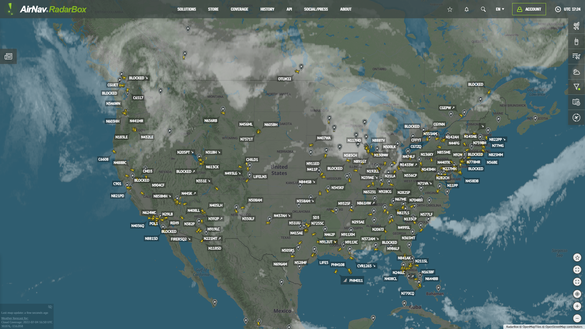
Besides all these features that provide information for pilots to navigate while flying, we have two focused map options: Sky Vector VFR and Sky Vector LO.
Sky Vector VFR/LO
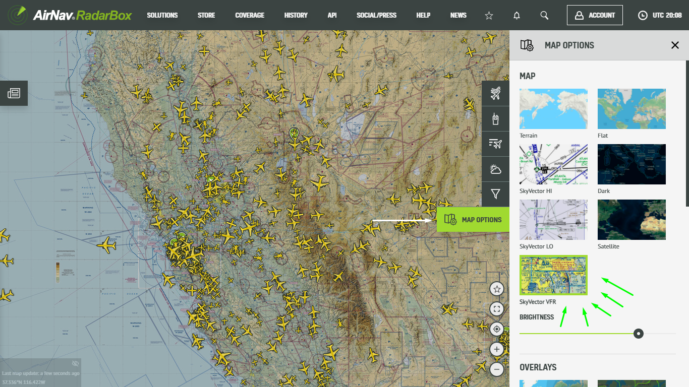
The image above: Sky Vector VFR Map
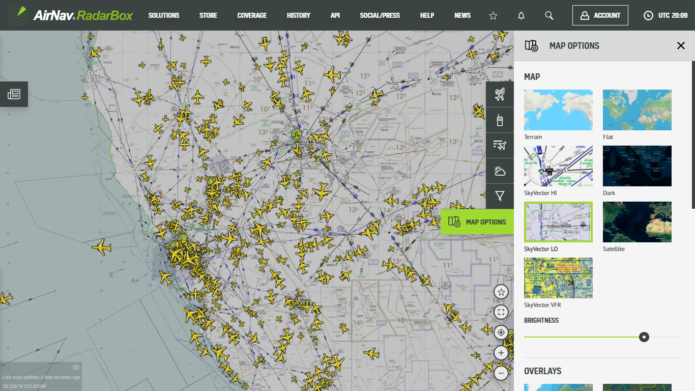
The image above: Sky Vector LO Map
The Sky Vector VFR/LO map option - the sky vector aeronautical chart - is an outstanding navigation reference and tool for pilots and crew during operations and fundamentally for flight planning.
How to activate SkyVector (VFR/LO) aeronautical chart on RadarBox.com
To use Sky Vector's aeronautical chart map option, go to the right side of the RadarBox.com page, select the sixth item, "Map Options," and double-click it. Then go to "Maps" and select one of the available maps. Done!
The image above: Sky Vector VFR Tutorial
The image above: Sky Vector LO Tutorial
How to activate NAVAIDs & Waypoints and Routes on RadarBox.com
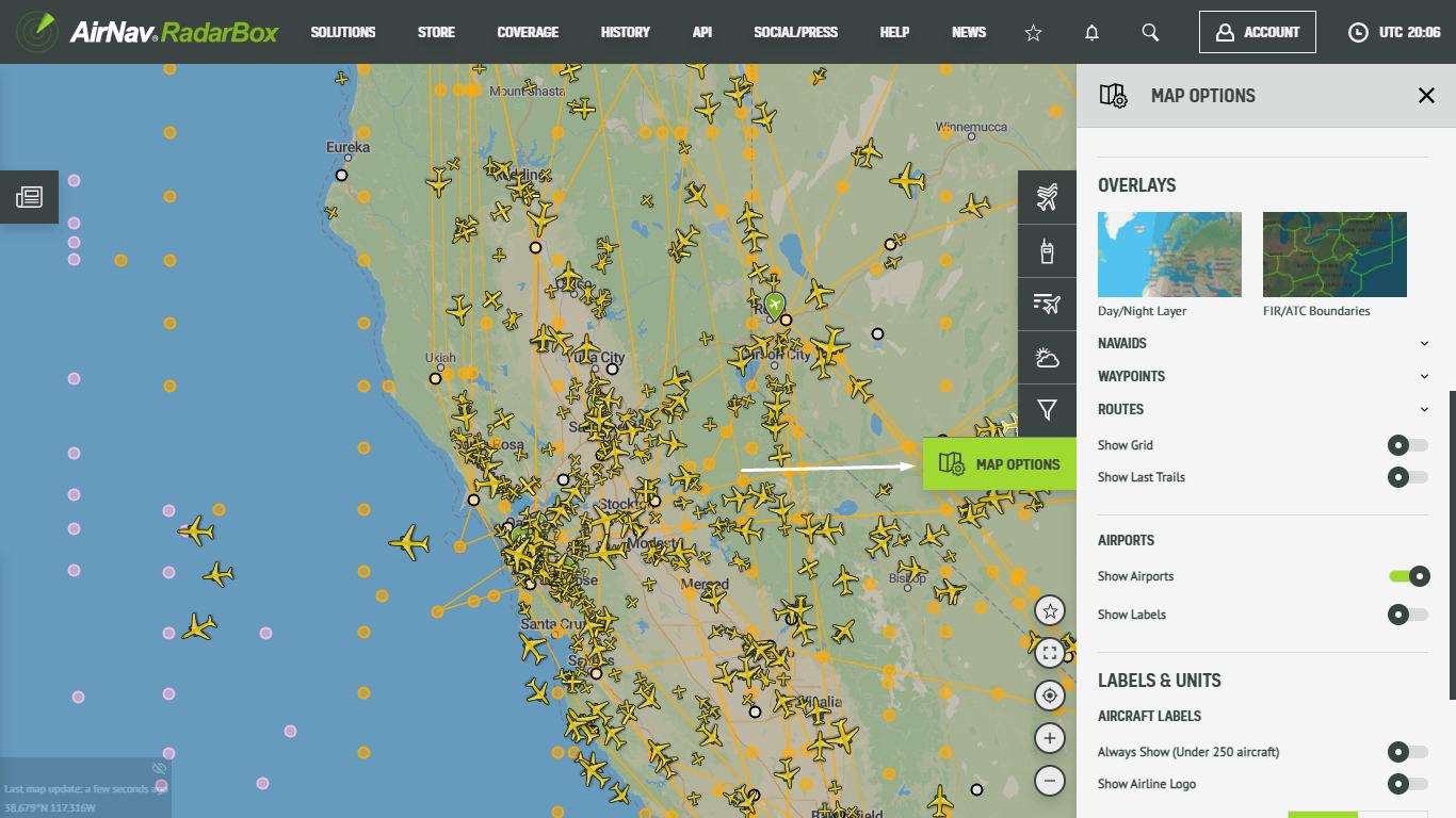
The image above: NAVAIDs, Waypoints & Routes Tutorial
To activate routes, navaids & waypoints, go to the right side of the RadarBox.com page, select the sixth item, "Map Options. After opening the tab, scroll down until you find "NAVAIDs, Waypoints & Routes", just click on one of the items (NAVAIDs, Waypoints, or Routes) or "^" and select the continents or regions that you want to activate on the RadarBox map.
The image above: Navaids, Waypoints & Routes Tutorial
Do you have any questions or feedback? Please send us a tweet with the hashtag: #RadarBox or send us an email with your problem/question or feedback to: support@radarbox.com
To receive some of these benefits, why not consider subscribing to RadarBox?
READ NEXT...
 201672
Tracking Helicopters With AirNav Radar
Today we'll explore how to filter and track helicopters on AirNav Radar. Read this blog post to learn more...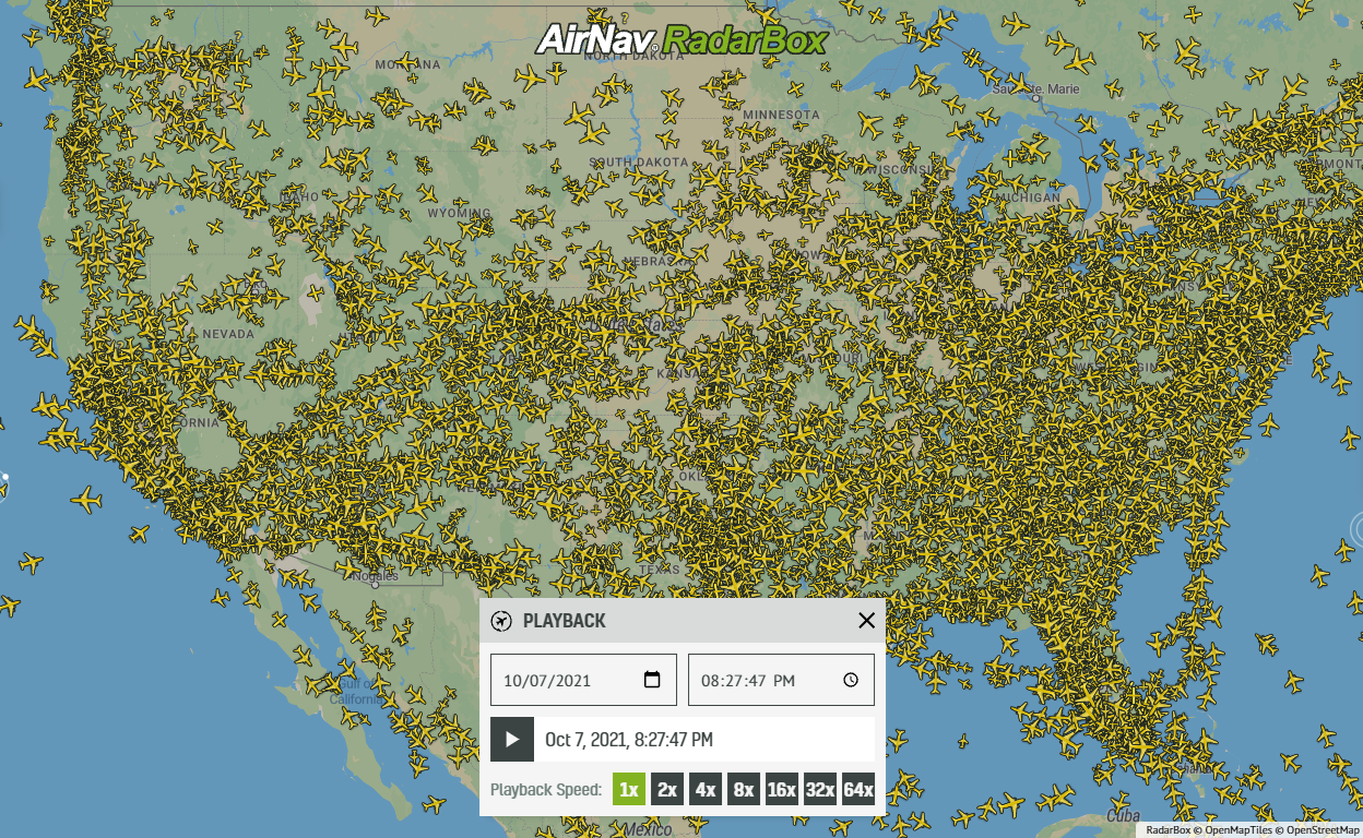 117282
Replay Past Flights with Playback
AirNav RadarBox officially launches the playback function on RadarBox.com, allowing users to replay the air traffic for a specific date and time in the past, within a 365-day period. Read our blog post to learn more about this feature. 87306
87306Taking a Trip Down Memory Lane: We Tracked Concorde!
A spotter in today's world would have reveled at the thought of being able to spot Concorde... Read our blog to find out more!